Why does the mountain look closer today?
Short answer
Usually one of two things. On cold, calm mornings a layer of cold air near the ground bends light from a distant peak downward more than usual, so the mountain is lifted, stretched or brought up from behind the horizon. That's looming, and in strong cases a superior mirage. Or the air is unusually clean, so the far ridge keeps its contrast and your brain reads sharp detail as near.
 Standing in front of one now? Mountain Identifier: Peaks labels the peaks in your camera view →
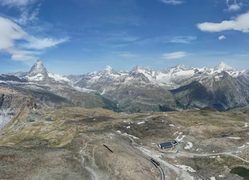
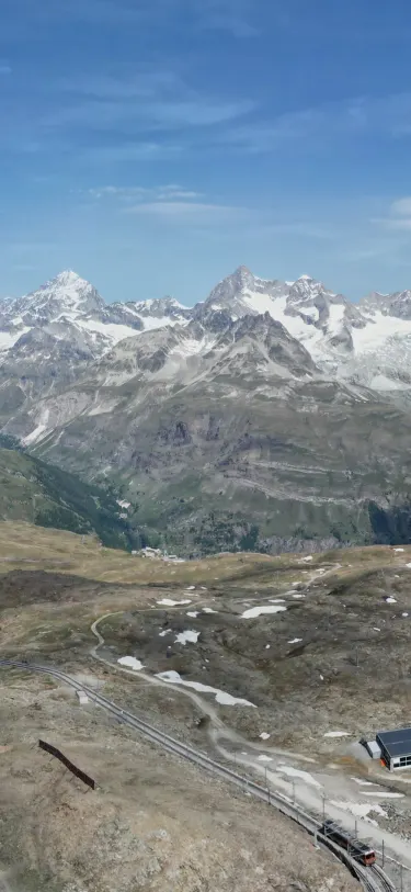 Dent Blanche4,358 m · 14.5 kmOber Gabelhorn4,073 m · 10.9 km9:41Dent Blanche4,358 m · 14.5 km away

Two different reasons, and they look different
A mountain you see every day hasn't moved. What changes is the air between you and it, and it can make a peak look closer in two quite different ways.
- The air bends the light more than usual. Light from a distant summit always curves a little on its way to you. When cold, dense air lies along the ground under warmer air, it curves much more. The mountain is lifted higher in your view, sometimes stretched taller, and peaks normally hidden by the curve of the Earth can rise into sight. This is looming, and its strong forms are superior mirages.
- The air is unusually clean. Nothing is lifted or stretched. The ridge just keeps its sharp edges and dark shadows instead of fading into haze, and your brain takes that as a sign it's near.
The first one changes where the mountain sits and what shape it is. The second changes only how crisp it looks. That difference is the easiest way to tell them apart.
Looming: when the air bends more than usual
Air gets thinner with height, so light passing through it bends slightly downward, following the curve of the Earth a little. Surveyors describe how much with a refraction coefficient, k. The standard value, about 0.13, is the one used in our guide to how far away you can see a mountain, and it works out to seeing over an Earth about 15% larger than the real one.
That 0.13 is an average, and near the ground it's often far off. Measuring it continuously with pairs of surveying instruments, Hirt and colleagues found a variation range of k between −4 and +16 near the ground on sunny summer days, and −2 to +5 under cloud. Their conclusion was blunt: the usual 0.13 isn't suited to describing refraction in the lower atmosphere.
A big positive k is looming. Andrew Young's mirage pages at San Diego State University quote an old description that still fits: "The visible effect is precisely the same as if the convexity of the surface of the earth were diminished." His models put the turning point at an inversion of about 0.11 °C per meter. At that rate, light curves as fast as the Earth does, and the ground looks flat out to the horizon.
Here's what that does to how much of a distant mountain sits below your horizon, for an eye at sea level:
| Distance | Hidden, average day (k = 0.13) | Strong looming (k = 0.5) | Light curving with the Earth (k = 1) |
|---|---|---|---|
| 50 km | 171 m | 98 m | 0 m |
| 100 km | 683 m | 392 m | 0 m |
| 150 km | 1,536 m | 883 m | 0 m |
| 250 km | 4,267 m | 2,453 m | 0 m |
We worked these out with the standard spherical-Earth formula (radius 6,371 km), ignoring terrain. Real inversions are rarely uniform all the way to the mountain, so treat the right-hand columns as what the physics allows, not a forecast. The point stands, though: on a strong looming day a range 100 km off can show hundreds of meters more of itself, which reads as a bigger, nearer mountain.
Towering and superior mirages: when the shape changes too
Uniform extra bending lifts a mountain without distorting it. Young's pages, following the 18th-century work of Lambert, note that a constant density gradient produces only a vertical displacement. When the temperature changes unevenly with height, the image gets stretched (towering) or squashed (stooping) as well, and he points out how small the temperature differences behind a large effect can be.
Push the inversion further and it can trap light in a duct. That's a superior mirage. Young's guide to mirage types says superior mirages usually involve three images: an inverted image between two erect ones, and it names distant mountains as a classic subject.
In practice you see a ridge with a flat, cut-off top, a band of sky that looks like it's floating, or low hills drawn up into cliffs. FOX Weather's explainer on the fata morgana, the most tangled kind of superior mirage, describes Blue Mound near Madison, Wisconsin, normally a small hill, looking like a mountain.
British hill forecasters see it too. A Mountain Weather Information Service forecaster photographed the Langdale Pikes in the Lake District from above Sedbergh on a chilly morning, with cloud lying below the summits, and the fells appeared taller and nearer than they actually are. He put it down to a likely superior mirage, while allowing that perspective might be part of it.
Denali from Fairbanks
Fairbanks is the textbook case. By our calculation it's about 254 km (158 miles) from Denali (20,310 ft / 6,190 m, the USGS figure from its 2015 survey). That's far enough for the curve of the Earth to hide most of the mountain. In a 1995 Alaska Science Forum column, a University of Alaska geophysicist calculated that from the top of an eight-story campus building you should see only about the top sixth of it.
Yet people in Fairbanks see it as a big mass on the southwest horizon. The column credits refraction, made stronger by the cold and warm layers of a temperature inversion, and notes the view keeps changing as the layers shift. FOX Weather's explainer names Fairbanks for the same reason: cold air settles into the Tanana River Valley beneath warmer air on the surrounding hills.
Clear air: why mountains look closer after a storm
The other kind of "closer" day needs no bending at all. Distance normally leaves its mark on a ridge: more air in front means less contrast, softer edges and a bluer tint, which is why distant mountains look blue. Your visual system uses that as a ruler. In a 1994 study in Vision Research, O'Shea, Blackburn and Ono found that the lower-contrast area of a display was judged farther away, and concluded contrast is an effective depth cue in the absence of any other depth information.
So when a cold front scrubs the haze out, a peak 60 miles away keeps the crispness of one 20 miles away, and it looks nearer and bigger than usual. Its size in your view hasn't changed. You're just reading the distance wrong. The opposite day, when the haze thickens until the range disappears, is covered in why you can't see the mountains today.
Which one are you seeing?
| What you notice | Looming or mirage | Clear air |
|---|---|---|
| Weather | Calm and cold near the ground, often early morning, over snow, a cold lake or the sea | Just after a front or rain has cleared the air |
| Shape | Peaks taller, flat-topped, stacked or floating; new peaks on the skyline | Normal shape, just sharper |
| Over time | Can shift over minutes; often fades as the sun warms the ground | Lasts all day |
| Near ridges | Look normal; the effect grows with distance | Everything looks crisp, near and far |
The "over time" row is the most reliable. Hirt's team found refraction near the ground swinging up and down over 10 to 30 minutes on sunny days. If you watch for a quarter of an hour and the skyline changes shape, it's the air.
What it means for peak labels
Mountain Identifier: Peaks computes where each peak should appear using the standard refraction coefficient of 0.13 plus the curve of the Earth, and checks line of sight against the terrain so peaks hidden behind a nearer ridge stay hidden. That's tuned for an average day.
On a strong looming day the real mountain sits a little higher than the model expects, so a far label can sit slightly below its summit, and a peak the model counts as hidden can be visible without a label. The app does lean toward showing a borderline peak rather than hiding it, but it can't know how the air is bending today.
The live view searches peaks within 80 km (about 50 miles), so a looming giant like Denali from Fairbanks is far outside what it labels. Identifying peaks in the live view is part of the Pro subscription. To check what's usually in view from where you are, see what mountains you can see from here.
Frequently asked questions
What is looming?
Looming is refraction stronger than normal, which lifts the image of a distant object above where it usually sits. It can bring a mountain or a far shoreline into view that's normally hidden below the horizon. Unlike a true mirage, the image isn't flipped upside down.
Why do mountains look bigger on clear days?
Mostly because of contrast. Haze softens distant ridges, and your visual system treats low contrast as a sign of distance. When a front clears the air, a far peak keeps its crisp edges and detail, so it reads as nearer and therefore larger, even though nothing about its angular size has changed.
Can refraction let you see past the horizon?
Yes. Light bends gently downward in the lower atmosphere, so you always see a little beyond the geometric horizon. With a temperature inversion it can bend much more, and peaks that are usually below the horizon can appear. That's how Denali is sometimes seen large from Fairbanks, about 158 miles away.
What is a superior mirage?
A superior mirage forms when a layer of warm air sits over cold air near the ground, steep enough to trap light in a duct. Distant objects appear raised, and often stacked as an upright image, an inverted one, and another upright one. A fata morgana is a complicated superior mirage that can turn low hills into walls and spires.
Why does a mountain look different from one minute to the next?
Refraction near the ground changes fast. A surveying study that measured it continuously found the bending wandering up and down over 10 to 30 minutes on sunny days. If a peak's height or shape seems to shift while you watch, that's the air changing, not the mountain.
Next time, point your phone at it.
Name, elevation and distance for the peaks in your camera view. Free to download; identification is part of Pro.
 Dent Blanche4,358 m · 14.5 kmOber Gabelhorn4,073 m · 10.9 km9:41
Last reviewed Nov 13, 2026. Peak data © OpenStreetMap contributors (ODbL).