What mountains can you see from San Francisco?
Short answer
From San Francisco's hills you see Mount Tamalpais (2,571 ft) about 23 km to the north-northwest across the Golden Gate, and Mount Diablo (3,849 ft), the lone peak about 49 km to the east-northeast. San Bruno Mountain fills the near horizon to the south. On clear days Mission Peak and Mount Hamilton, with the white domes of Lick Observatory, show up to the southeast, 57 and 84 km away.
 Standing in front of one now? Mountain Identifier: Peaks labels the peaks in your camera view →
Point your iPhone at the skyline from anywhere in San Francisco.
The app works out which peaks you can see from that exact spot. This is roughly what it shows from Twin Peaks.


Scan to get it
Drawn from the bearings, distances and heights in the table below, with heights exaggerated.
The San Francisco skyline, north to south
San Francisco is ringed by water, so its mountains sit across the Bay and the Golden Gate rather than behind the city. Climb any of the hills and the same handful of summits comes round. These are the ones worth knowing, measured from Twin Peaks:
| Peak | Direction | Distance | Elevation |
|---|---|---|---|
| Mount Tamalpais (East Peak) | North-northwest (330°) | 23 km / 14 mi | 2,571 ft / 784 m |
| Mount Saint Helena | North (351°) | 103 km / 64 mi | 4,342 ft / 1,323 m |
| Mount Diablo | East-northeast (73°) | 49 km / 31 mi | 3,849 ft / 1,173 m |
| Mission Peak | East-southeast (118°) | 57 km / 35 mi | 2,520 ft / 768 m |
| Mount Hamilton (Lick Observatory) | Southeast (123°) | 84 km / 52 mi | 4,265 ft / 1,300 m |
| San Bruno Mountain (Radio Peak) | South (171°) | 7 km / 4 mi | 1,319 ft / 402 m |
Bearings and distances are worked out from the summit coordinates on each peak's Wikipedia page. Elevations come from the National Geodetic Survey data sheets cited there for Diablo, Saint Helena, Hamilton (the observatory benchmark) and San Bruno, from California State Parks for Tamalpais, and from Peakbagger for Mission Peak. Older USGS name-database figures differ by a few feet, as Wikipedia's list of Bay Area summits shows.
Twin Peaks stands about 925 ft (282 m) up, so from there the view clears most of the city. From the flats near the Bay you'll see less, and which summits make it over the nearer hills depends on the street. Our guide to what mountains you can see from where you are walks through that check.
Mount Tamalpais, across the Golden Gate
The long mountain rising behind the Marin Headlands is Mount Tamalpais, "Mount Tam" to everyone in the Bay Area. Wikipedia's article says it's clearly visible from parts of San Francisco and the East Bay, and from Twin Peaks it fills the view just left of the bridge towers.
It has three summits. The East Peak, at 2,571 ft, carries a fire lookout. The West Peak is a few feet higher and is the one with the radar dome. You may hear the outline called the Sleeping Lady; Wikipedia traces that story to a playwright, not to Coast Miwok tradition.
Far beyond Tam, almost due north, the clearest days can show a summit in the Mayacamas range. Wikipedia's Twin Peaks article says the northward view reaches Cobb Mountain, about 120 km off. Mount Saint Helena, the high point above Calistoga, is 103 km from Twin Peaks. Treat either as a rare sighting, not something to expect.
Mount Diablo, the lone peak to the east
Mount Diablo is only 3,849 ft, but it stands almost by itself above the flat country around it. That isolation is the point. California State Parks puts it plainly: "As mountains go, Mount Diablo isn't particularly tall," and then explains that you can see parts of 40 of California's 58 counties from the top. Its prominence, 3,109 ft by Peakbagger's figure, is most of its height, which our guide to mountain prominence explains.
From Twin Peaks it sits on the horizon east-northeast, beyond the Oakland and Berkeley hills. By our line-of-sight arithmetic it clears those hills by a comfortable margin from Twin Peaks, but from low ground near the waterfront only its top makes it over them, and from some streets it's hidden. From the city it reads as one peak with a lower shoulder on its left: that's North Peak (3,557 ft), about a mile northeast of the main summit.
The summit was the starting point for California's land surveys. In 1851 it was chosen as the initial point of the Mount Diablo Meridian and Base Line, which surveys across Northern California and Nevada still reference.
Southeast: Mission Peak and Lick Observatory
Look past the south end of the Bay on a clear day and two summits stand out above Fremont and San Jose. Mission Peak, 57 km away, is the sharp top of the ridge east of Fremont.
Farther right and higher is Mount Hamilton. The white specks along its crest are the domes of Lick Observatory, at about 4,265 ft by the NGS benchmark. The true high point of the ridge, Copernicus Peak, is a little over 4,360 ft and is the highest point in Santa Clara County. Wikipedia says Hamilton can get snow up to a dozen times a winter, so a white summit to the southeast after a cold storm is most likely it.
South: San Bruno Mountain
The big, bare ridge closing off the south end of the city is San Bruno Mountain. Wikipedia says that from downtown it "occupies the southern horizon". Its top, Radio Peak, carries the broadcast towers. Most of it is a state and county park, home to the endangered Mission blue butterfly.
Montara Mountain (about 1,900 ft), 25 km away above Pacifica, lines up only 5° to the right of San Bruno from Twin Peaks, so from there the two are easy to mistake for one ridge.
When the fog hides everything
Summer is the worst season for mountain views in San Francisco. The marine layer pours in through the Golden Gate from roughly June to September, often burning back by midday and returning in the late afternoon. A clear morning can turn into a blank horizon by the time you've walked up.
For the long views, go after a winter storm has cleared the air. Wikipedia notes the same thing about the view from Diablo's summit. Our guide to why you can't see the mountains today covers fog, haze and smoke in more detail.
The Sierra and Lassen: from Diablo, not the city
We couldn't find a reliable record of anyone seeing the Sierra Nevada from the city itself. The nearest crest is well over 200 km away, and by our arithmetic the Oakland and Berkeley hills stand higher above the horizon from Twin Peaks than the Sierra would.
From Diablo's summit it's a different story. State Parks says that when conditions are best you can see almost 200 miles, with the Sierra crest to the east and Lassen Peak in the Cascades to the north. Lassen is 291 km (181 mi) from Diablo, and our guide to how far away you can see a mountain shows how much of a peak the Earth's curve hides at that range.
Naming the peaks with an app
Mountain Identifier: Peaks labels the summits in your camera view with name, elevation and distance, and checks the terrain in between so a peak behind a nearer ridge doesn't get a label. The live view is part of the Pro subscription, and it searches peaks within 80 km of you. From San Francisco that splits the skyline:
- Inside the range: Mount Tamalpais, Mount Diablo, Mission Peak and San Bruno Mountain, from Twin Peaks or anywhere else in the city.
- Outside it: Mount Hamilton is 84 km from Twin Peaks and about 83 km from the Ferry Building, just past the limit, so the app won't label it from the city even when you can see the domes. Mount Saint Helena is out too.
- From Diablo's summit: Tam (about 59 km) is in range; the Sierra and Lassen are far beyond it.
If the labels sit beside the real summits, the phone's compass is usually off; drag one finger sideways to rotate them into line. For another coastal city with a split skyline, see what you can see from Los Angeles.
Frequently asked questions
What is the big mountain east of San Francisco?
Mount Diablo, 3,849 ft (1,173 m), about 49 km (31 mi) east-northeast of Twin Peaks in Contra Costa County. It stands almost alone above low country, which is why it's visible from most of the Bay Area even though it isn't especially high.
Can you see the Sierra Nevada from San Francisco?
Not reliably. The crest is well over 200 km away and the East Bay hills stand in the way from most of the city. The dependable view is from Mount Diablo's summit, where California State Parks says the Sierra crest 'seems to float in space' on the best days.
What is the highest point in San Francisco?
Mount Davidson, at 928 ft (283 m), just south of Twin Peaks and topped by a large concrete cross. Twin Peaks, at about 925 ft, is a whisker lower but has the open summit and the better view of the mountains around the Bay.
What is the mountain north of the Golden Gate Bridge?
Mount Tamalpais, in Marin County, about 23 km (14 mi) north-northwest of Twin Peaks. Its East Peak, with a fire lookout on top, is 2,571 ft (784 m). The West Peak is a few feet higher and carries a radar dome.
What mountain has the domes south of San Francisco?
Mount Hamilton, east of San Jose. The white domes are Lick Observatory, at about 4,265 ft (1,300 m). From Twin Peaks it's about 84 km (52 mi) to the southeast, so it only stands out on clear days.
Next time, point your phone at it.
Name, elevation and distance for the peaks in your camera view. Free to download; identification is part of Pro.

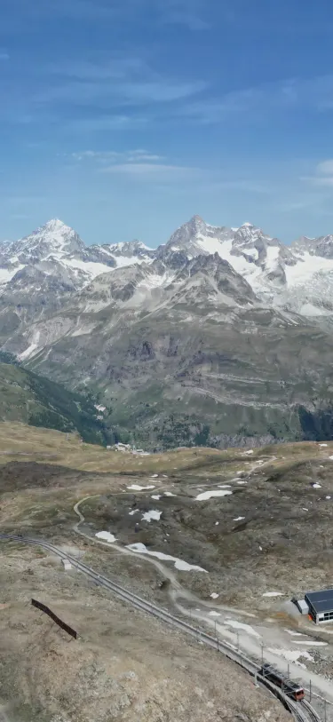 Dent Blanche4,358 m · 14.5 kmOber Gabelhorn4,073 m · 10.9 km9:41
Last reviewed Nov 9, 2026. Peak data © OpenStreetMap contributors (ODbL).