How is mountain elevation measured?
Short answer
Mountain elevation is the height of the summit above mean sea level, extended under the land as a gravity surface called the geoid. Surveyors used to get it by triangulation and leveling. Now they put a GNSS receiver on the summit, which gives height above a mathematical ellipsoid, then subtract the local geoid height from a gravity model. Everest's 8,848.86 m, announced in 2020, was measured this way.
 Standing in front of one now? Mountain Identifier: Peaks labels the peaks in your camera view →
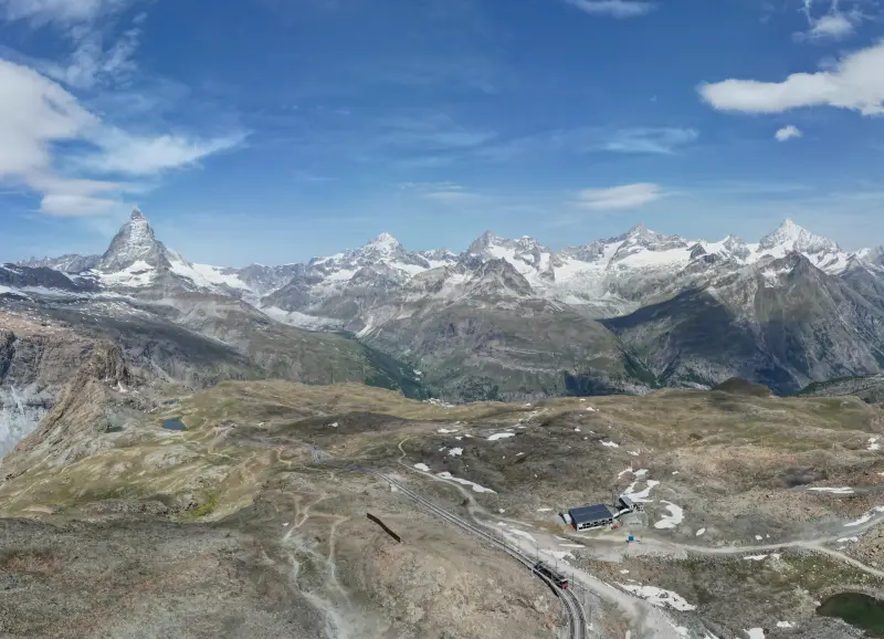
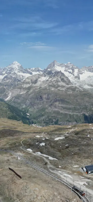 Dent Blanche4,358 m · 14.5 kmOber Gabelhorn4,073 m · 10.9 km9:41Dent Blanche4,358 m · 14.5 km away

Elevation means height above sea level, which is harder than it sounds
A mountain's elevation is how far its summit sits above mean sea level. The catch is that the sea doesn't reach under Mont Blanc. Surveyors extend it inland as the geoid: the surface the oceans would settle into if they could flow through the continents, shaped only by gravity and the Earth's spin. Because gravity varies with the rock underneath, the geoid has bumps and dips of tens of meters.
Satellite positioning doesn't see the geoid. GPS and the other GNSS systems measure height above an ellipsoid, a smooth mathematical shape that roughly fits the Earth. The gap between the two is the geoid height, and converting is a subtraction: elevation equals ellipsoid height minus geoid height. In the lower 48 US states the geoid sits 8 to 53 m below the ellipsoid, according to the National Geodetic Survey. Get the geoid wrong and every summit in the region is wrong by the same amount.
How surveyors measure a summit
Three methods have done most of the work, roughly in historical order:
- Triangulation. Measure the angle up to the summit from two or more stations of known position and height, then solve the triangle. The Great Trigonometric Survey of India measured Everest this way from more than 100 miles away and reported 29,002 ft in the 19th century, as JSTOR Daily recounts. Long sightlines bend in the air, so refraction has to be estimated, and the curve of the Earth has to be taken out (our guide to seeing distant mountains shows how much it hides).
- Leveling and photogrammetry. Leveling carries a known height inland from a tide gauge, a few meters at a time. Mapping agencies such as Ordnance Survey then measure most of their spot heights from overlapping aerial photos. It's efficient for a whole country, but less precise on any one summit.
- GNSS on the summit. A receiver logs satellite data for hours, then the height is computed against nearby control points and a local geoid model built from gravity measurements. With survey-grade procedures, GPS World puts the result typically within about 2 cm.
Aircraft lidar and radar now map whole ranges, too. They're good at terrain but weaker at a single pointed top: the USGS rejected a 2013 airborne radar figure for Denali because that method "does not provide precise spot or point elevations, especially in very steep terrain".
How Everest and Denali got their current heights
Everest's 8,848.86 m (29,031.7 ft) came from two national surveys. Nepal's Survey Department ran precise leveling 248 km from the lowlands toward the mountain, set up GNSS control points, and measured gravity to model the geoid, then sent a team to the summit on May 22, 2019 to log GNSS data, Record Nepal reported. China placed a BeiDou receiver on the summit in 2020, and the two countries announced the shared figure on December 8, 2020.
That number is the top of the snow. A 2023 paper in The Cryosphere notes that the rock height is still unknown and puts the mean snow depth at the summit at 9.5 ± 1.2 m, much deeper than older estimates.
Denali went from 20,320 ft to 20,310 ft (6,190 m) after a GPS survey in June 2015. Surveyors probed the ice cap but couldn't find the rock summit, so the official height is the top of the ice, which they estimated at 13.6 ft deep.
Why the same peak has different heights in different sources
Two maps disagreeing about a summit is normal. The usual reasons:
- Different surveys. A map may still print a figure from photogrammetry decades old. Alan Dawson has GNSS-surveyed over 2,000 British summits and reports that 58% of the published heights were off by a meter or more, though 97% were within 3 m. That's one surveyor's campaign, not an Ordnance Survey audit.
- Snow or rock. Everest and Denali are measured to the snow and ice. China's 2005 figure for Everest, 8,844.43 m, measured the rock instead, so it came out lower.
- Different vertical datums. Each country defines its own "sea level". Most differ from the global model by less than a meter, so this matters less than people expect.
- Rounding and conversion. Feet converted to meters and back, or a height rounded to fit a small-scale map.
- Copying. Websites and databases repeat each other, errors included.
OpenStreetMap, the source of the peak data in Mountain Identifier: Peaks, adds its own layer. Its elevation tag is meant to be whole meters above mean sea level, but contributors take values from signs, published maps and GPS traces, so quality varies. Of 687,599 summits in the app's database, 74.5% carry an elevation at all. Everest is stored as 8,849 m, the 2020 figure rounded.
Why your phone's altitude disagrees with the map
If your watch says 3,190 m on a summit marked 3,212 m, the map is almost certainly the better number. Satellite fixes are much less precise vertically than horizontally, as the OpenStreetMap wiki warns mappers. A device that reports raw ellipsoid height can be off by far more: the difference from sea level reaches about 100 m in places.
iPhones do convert to sea level; Apple's Core Location documentation says the altitude it reports is approximated from the EGM2008 geoid model, with a separate vertical accuracy figure. For a summit, trust the surveyed height.
Tallest depends on what you measure
| Measure | Winner | Figure |
|---|---|---|
| Height above sea level | Everest | 8,848.86 m (29,031.7 ft) |
| Base to summit | Mauna Kea | more than 10,210 m (33,500 ft), from the Pacific floor |
| Distance from Earth's center | Chimborazo | more than 2,072 m (6,800 ft) farther out than Everest's summit |
Mauna Kea rises only 4,207 m (13,803 ft) above sea level, per the USGS Hawaiian Volcano Observatory. Chimborazo, at 6,268 m (20,564 ft), wins the third measure because it sits just south of the equator, where the Earth bulges, as NOAA explains. None of these is how high a mountain looks; that's closer to prominence, which is also how lists settle the mountain-or-hill question.
Where the heights in Mountain Identifier: Peaks come from
The peak heights bundled in the app come from OpenStreetMap, so a label can disagree with your local map for the reasons above. In the live view, which is part of Pro, each flag shows a peak's name, elevation and distance.
To place the flags, the app works out your own height from terrain data plus a fixed 2 m eye height, and it corrects the angle to each peak for curvature and refraction, the same two effects the old triangulators had to remove. For what the database does and doesn't hold, see how many mountains there are.
Frequently asked questions
Is mountain height measured from sea level?
Yes. Official elevations are measured from mean sea level, carried inland as the geoid, a surface of equal gravity. That's why a peak's height doesn't depend on where you stand or on the ground around its base.
Why does my GPS show a different altitude than the map?
Satellite positioning is much less precise vertically than horizontally, so a phone or watch reading wanders. A device that reports raw height above the ellipsoid, not sea level, can be off by up to about 100 m. A map's printed spot height comes from a survey, so trust that.
How was Everest measured?
Nepal and China surveyed it separately in 2019 and 2020. Teams carried GNSS receivers to the summit, used radar to probe the snow, and combined that with leveling from the coast and gravity surveys to model the geoid. Both countries announced 8,848.86 m in December 2020.
Is Mauna Kea taller than Everest?
Measured from its base on the Pacific floor, yes: NOAA puts Mauna Kea at more than 10,210 m base to summit. Above sea level it's 4,207 m, so Everest is higher. Chimborazo's summit is farthest from Earth's center.
Do mountains change height?
Some do, slowly. The Himalayas are still rising as the Indian plate pushes north, earthquakes can raise or drop a summit, and snow on top changes with the seasons. Most changes in published heights come from better surveys, though.
Next time, point your phone at it.
Name, elevation and distance for the peaks in your camera view. Free to download; identification is part of Pro.
 Dent Blanche4,358 m · 14.5 kmOber Gabelhorn4,073 m · 10.9 km9:41
Last reviewed Oct 23, 2026. Peak data © OpenStreetMap contributors (ODbL).